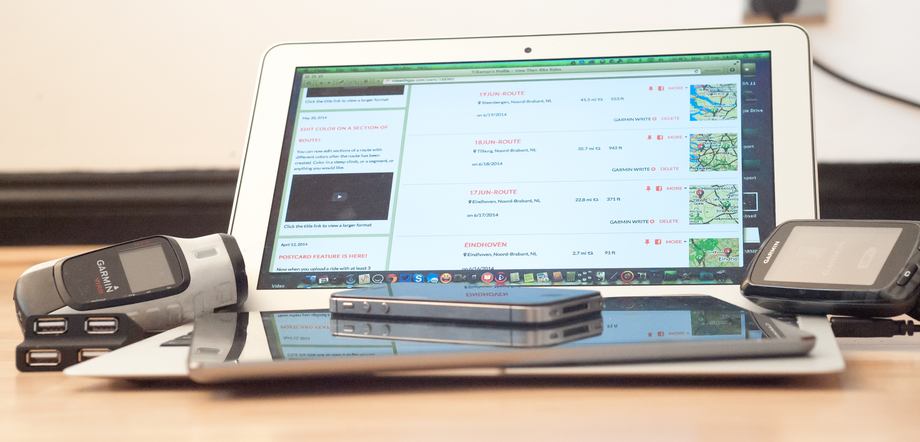
Having just returned from a 12-day cycle-touring holiday (you missed me, right?), it occurred to me how much the activity has changed over the years. The basics are still the same, of course: turning the pedals makes the scenery pass slowly by, and by the end of the day you’re 40 or 50 miles away from where you had breakfast. But what used to be a very low-tech activity, involving little more than a paper map and compass, has now turned into something of a technofest – at least for me and a fellow geek friend who joined me. And my MacBook Air, iPad and iPhone are all integral parts of the trip …
Planning
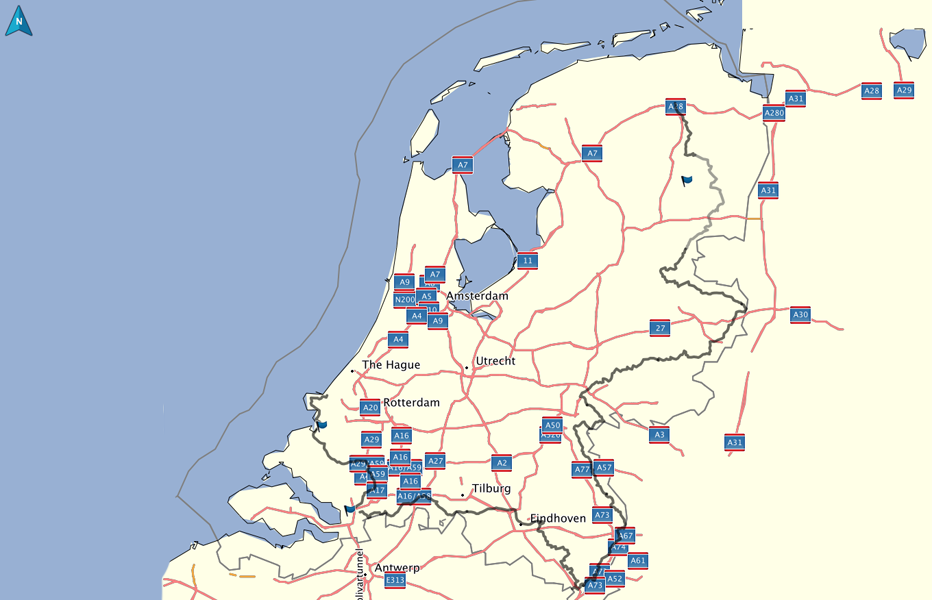
Last year’s tour was from Hook of Holland to Esbjerg in Denmark. That took in the west and north edges of the Netherlands, so this year the obvious thing to do was complete a lap of the country by cycling along the eastern and southern edges.
There’s an official Ronde van Nederland (’round the Netherlands’) route created by the Dutch tourist organisation, and they helpfully put the GPX files online. This is, however, too big a file to load in as a single route, so before the holiday I’d loaded it into Garmin’s Basecamp software and chopped it up into roughly 50-mile chunks to form the guideline route for each day.
Beyond that, the only additional planning was booking the ferry to Holland, train tickets to our starting-point in the north-east corner of the country and our first night’s accommodation.
Oh, and if you think my bike looks a little unusual when you see glimpses of it, that’s because it is: it’s an ICE recumbent trike – the most comfortable way to cycle!
Breakfast
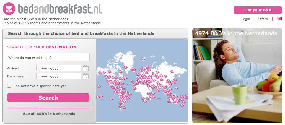
The first task each morning was to see roughly where we wanted to end up at the end of the day, and to find accommodation somewhere in the vicinity. This was done over breakfast. Out came my 11″ MacBook Air in order to visit bedandbreakfast.nl and hotels.com. We of course checked ‘free WiFi’ in the filter list to ensure we’d be able to do the same thing the next day. As I was using the MBA, I used the websites, but there is of course a hotels.com iOS app that would have done otherwise,
It wasn’t always possible to find somewhere to stay exactly on the route, so we booked the closest place we could find, which gave us our actual destination for the day. Usually this was reasonably close, though we did need to borrow a bit of Germany for one night.

Accommodation booked, the next task was to plot a route to the guesthouse or hotel. Basecamp isn’t brilliant at plotting cycle routes, so for that we used a mix of ridewithgps.com and bikeroutetoaster.com. The routes they came up with weren’t necessarily exactly the same as the official route, but with the addition of an en-route waypoint or two, we could get close enough for government work.
I exported the GPX file from the website and then connected my Garmin Edge 810 GPS unit to the MacBook Air to copy the file across. As a belt-and-braces measure, I also put the address into Basecamp as a waypoint and used the software’s Transfer feature to copy that to the GPS also.
Cycling
Having delegated navigation to the Garmin GPS, we could then sit back and enjoy the view – taking plenty of photos along the way.
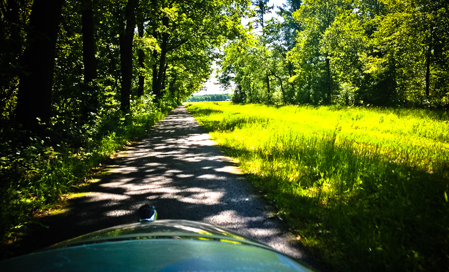
Despite my love of photography, a proper camera is too big and unwieldy for use when cycling. I used to carry a pocket camera, but the iPhone is just as good as a dedicated point-and-shoot these days, so that served as my only camera for stills.
Most of the photos are taken while cycling, so it’s handy to have some protection in case the camera ends up bouncing down the road. I used it in an Otterbox Defender Ion protective case that has the additional virtue of doubling the battery-life of the phone.
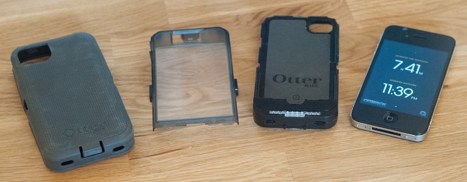
In practice, the supplementary power probably wasn’t necessary – with international data-roaming an expensive business, the phone wasn’t used for much else beyond a bit of text messaging – but it never hurts to have some peace of mind.
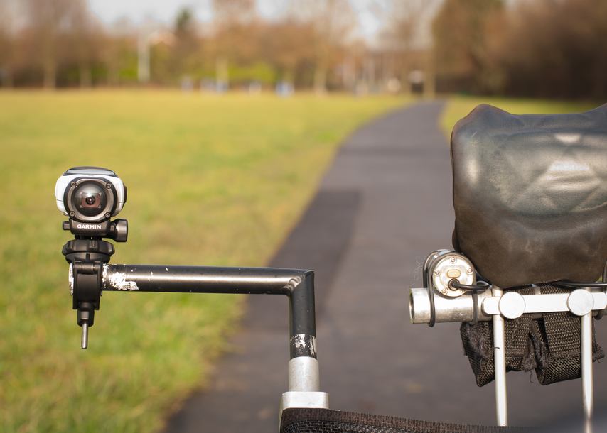
I also have a Garmin Virb Elite camcorder attached to my bike, and that was used to shoot a few video clips here and there, just to give a flavor of the ride.
The Garmin logs automatically collected fitness data which was synced to the Garmin Connect on my iPhone. A service called Tapiriik theoretically syncs that data to Strava, though in practice often doesn’t. I could have used the Strava app if I’d been bothered, but I didn’t expect to be setting any Strava records.
Dinner
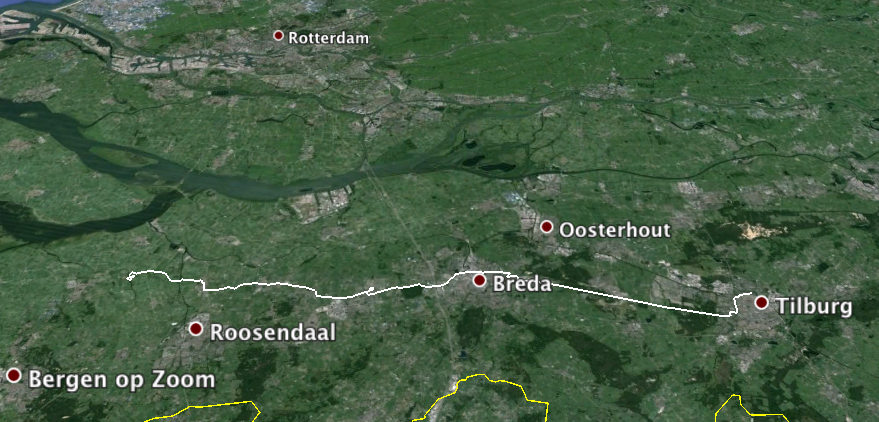
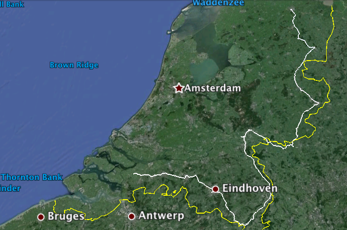
Over dinner was when all the technology came out! I first connected the GPS to the MacBook Air to grab the GPX tracklog of the day’s ride. This was loaded into Basecamp and then the ‘View in Google Earth’ feature used to give a sense of the day. I created two images, one with just that day’s ride, the other the ride as a whole to date.
Next up, I used Image Capture on the MacBook Air to grab the photos from the iPhone and import them into Lightroom. Shooting while cycling means a crop is usually required to straighten the horizon. I view cycling photos more as memory than art, so after that I just have a standard preset that I apply to all the shots, enabling me to process them all in just a few minutes.
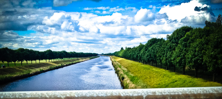
I then write a quick blog, incorporating the photos. This is mostly for friends back home to enjoy the journey vicariously, and to provide memories of the trip when I’m sitting in my rocking-chair aged 95.
Finally, I import the video clips from the camcorder. A few of these get posted to Facebook – such as this wonderful suspended roundabout for cyclists in the form of a circular suspension bridge on the outskirts of Eindhoven.
youtube=https://www.youtube.com/watch?v=FDbShXCq2hM
Most of the videos, though, are simply stored on the MacBook Air ready to be edited together sometime after I get home.
Evening
My iPad Air provided evening entertainment. It long replaced my Kindle as my main ebook reader, and with perfect timing Netflix released season 2 of Orange is the New Black shortly before the holiday. I just made it through the season over the 12 days.
Finally, of course, all that technology needed to be charged! I carried just the MacBook Air power supply, a tiny four-port USB hub plugged into a USB plug adapter – and three USB cables. The USB hub couldn’t supply enough power for the iPad, so that was recharged from the MacBook. iPhone, Garmin GPS and Garmin camcorder were all charged from the USB hub.
The phenomenal battery-life of the Hasewell-powered MacBook Air was a huge help, enabling me to use it throughout the evening without power – as well as during some of the lunch-stops – only charging it overnight.
The small size of the 11″ MacBook Air was also key: I travel light, with a total of just 25 litres of luggage space, about half of which is taken up with cycling gear (waterproofs, extra layers, gloves, lock and so on). That leaves just one pannier for three days of clothing (we do laundry along the way), toiletries – and technology.
Purists may object that cycling holidays should be all about nature and the simple machinery of bicycles, but having toured both with and without technology, I’m not going anywhere without mine!
FTC: We use income earning auto affiliate links. More.



Great to see you’ve enjoyed our beautiful little country!
It’s my all-time favourite place to cycle: flat, fantastic cycle paths and drivers who give way to cyclists at every opportunity, even when ignorant foreigners get it wrong.
Are typical bicycles faster then recumbent ones?
Recumbents are generally faster on flat roads. Road bikes are generally faster on hills. That said, you could put Lance Armstrong (clean or doped up) on anything and it will be faster than any other bike on the road.
On the flat, there’s not a lot in it (until you get to fully-faired ones). Recumbents are faster downhill and slower uphill.
Thanks for your report. I guess I would’ve looked for a way to let my 11″ MBA at home and just use iPhone and iPad. Would be too much worried about its health – either a crash or an unexpected rain shower…
It lived in a BookBook case inside a dry-sac in my panniers :-)
You should try out Co-Rider, a iPhone app that can do turn-by-turn navigation on routes from ridewithgps.com without the need for a Garmin GPS.
Full disclosure: I made Co-Rider. :-)
There are quite a few navigation apps around, but an iPhone screen isn’t very readable in daylight, especially in the powered case you’d need to use GPS all day.
One good thing for travelling is to use the offline-maps from Nokia.
Just got a 1520, a 6″ monster of a phone, which will double as GPS on my BMW-Mc.
I’d really like to only take my iPad (it´s made for that!) and my Garmin (USB) with me while traveling. But Apple just wants me to buy an MBA too. I just want USB support (at least for Garmins) on my iPad… Apple, please!
Before last year’s trip I did see a clunky way to do it via the Camera Connection Kit, but I’d been wanting an excuse to buy a MBA ever since the first one was launched …
If you tried to pack as light as possible, what uses justified taking the iPad if you are already took the MacBook Air?
The iPad is more comfortable reading or watching Netflix in bed :-)
Nice to see someone who enjoys the Dutch country as much as I do (as a Dutchman a little biased ;) ).
My own bike trip to the French Alps last week was one of a really light-travel kind. One backpack and a huge Bicycle-suitcase was all I had with me. On cycle-trips I only took along my iPhone and my Garmin forerunner watch. Besides the obvious drinks and foods. Alpe d’Huez is not for the fainthearted I can assure you ;)
My love of the Netherlands and its lack of Alps are not entirely unrelated. :-)
Lol